Products ![]() GeoExplorer Software
GeoExplorer Software ![]() UAV/Drone
UAV/Drone
UAV/Drone
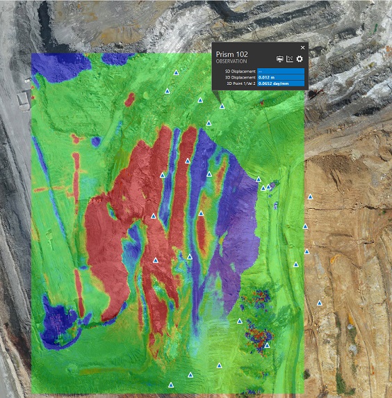
GeoExplorer’s Remote Sensing Module has been used successfully with data from UASs/drones. Point clouds generated using photogrammetry and processed to provide displacement models can be uploaded and analysed using the tools used for other remote sensing data sets.