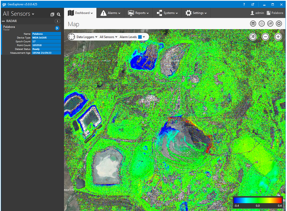
InSAR is a powerful technology for monitoring deformation over a large area with high precision. We are pleased to announce that we have added native integration for InSAR data collected by all the major providers. User friendly tools for loading and querying this data make it a valuable addition to our GeoExplorer software.

News ![]() InSAR Data Integrated Into GeoExplorer
InSAR Data Integrated Into GeoExplorer
InSAR Data Integrated Into GeoExplorer
December 19, 2014
GeoExplorer
Continue reading
NavStar Collaboration with Durham University
NavStar is assisting researchers from Durham University’s Geography Department to monitor coastal cliffs using the GeoExplorer integrated monitoring system. The system now forms an integral part of a project aimed at understanding the mechanisms involved in the erosion of cliffs and developing new ways to predict slope failures.

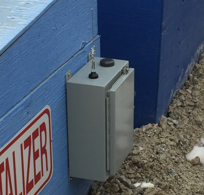
NavStar’s New Ultra Low-Power Monitoring Sensors
NavStar has released a new range of sensors that provide major benefits when compared to the conventional monitoring hardware.
Wireless Mesh Network Support Added
With the release of our GMS300X series GPS units we have added mesh networking capabilities.